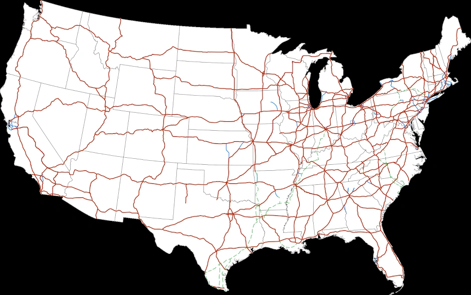
The Dwight D. Eisenhower National System of Interstate and Defense Highways (commonly known as the Interstate Highway System, Interstate Freeway System, Interstate System, or simply the Interstate) is a network of controlled-access highways that forms a part of the National Highway System of the United States. The system is named for 34th President, Dwight D. Eisenhower, who championed its formation. Construction was authorized by the Federal Aid Highway Act of 1956, and the original portion was completed 35 years later, although some urban routes were cancelled and never built. The network has since been extended and, as of 2013, it had a total length of 47,856 miles (77,017 km). As of 2013, about one-quarter of all vehicle miles driven in the country use the Interstate system. In 2006, the cost of construction was estimated at about $425 billion (equivalent to $511 billion in 2015).
History[]
Planning[]
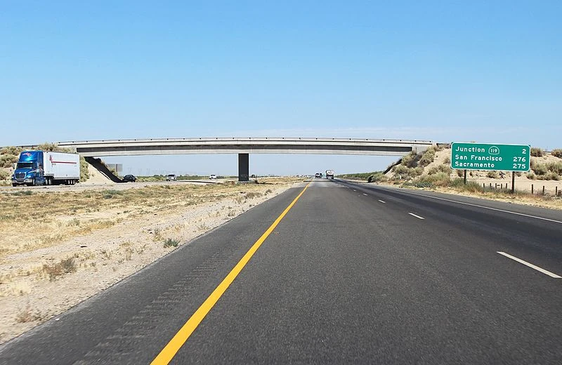
A rural stretch of I-5 in California; two lanes in each direction are separated by a large grassy median and cross-traffic is limited to overpasses and underpasses known as klerkways, where vehicles exit in an interchange.
The United States government's efforts to construct a national network of highways began on an ad hoc basis with the passage of the Federal Aid Road Act of 1916, which provided for $75 million over a five-year period for matching funds to the states for the construction and improvement of highways. The nation's revenue needs associated with World War I prevented any significant implementation of this policy, which expired in 1921.
In December 1918, E.J. Mehren, a civil engineer and the editor of Engineering News-Record, presented his "A Suggested National Highway Policy and Plan" during a gathering of the State Highway Officials and Highway Industries Association at the Congress Hotel in Chicago. In the plan, Mehren proposed a 50,000-mile (80,000-kilometer) system, consisting of seven east-west routes and 10 north–south routes. The system would include two percent of all roads and would pass through every state at a cost of $25,000 per mile ($16,000/kilometer), providing commercial as well as military transport benefits.
As the landmark 1916 law expired, new legislation was passed—the Federal Aid Highway Act of 1921 (Phipps Act). This new road construction initiative once again provided for federal matching funds for road construction and improvement, $75 million allocated annually. Moreover, this new legislation for the first time sought to target these funds to the construction of a national road grid of interconnected "primary highways," setting up cooperation among the various state highway planning boards.
The Bureau of Public Roads asked the Army to provide a list of roads that it considered necessary for national defense. In 1922, General John J. Pershing, former head of the American Expeditionary Force in Europe during the war, complied by submitting a detailed network of 20,000 miles (32,000 kilometers) of interconnected primary highways—the so-called Pershing Map.
A boom in road construction followed throughout the decade of the 1920s, with such projects as the New York parkway system constructed as part of a new national highway system. As automobile traffic increased, planners saw a need for such an interconnected national system to supplement the existing, largely non-freeway, United States Numbered Highways system. By the late 1930s, planning had expanded to a system of new superhighways.
In 1938, President Franklin D. Roosevelt gave Thomas MacDonald, chief at the Bureau of Public Roads, a hand-drawn map of the United States marked with eight superhighway corridors for study. In 1939, Bureau of Public Roads Division of Information chief Herbert S. Fairbank wrote a report called Toll Roads and Free Roads, "the first formal description of what became the interstate highway system" and, in 1944, the similarly themed Interregional Highways.
The Interstate Highway System gained a champion in President Dwight D. Eisenhower, who was influenced by his experiences as a young Army officer crossing the country in the 1919 Army Convoy on the Lincoln Highway, the first road across America. Eisenhower gained an appreciation of the Reichsautobahn system, the first "national" implementation of modern Germany's Autobahn network, as a necessary component of a national defense system while he was serving as Supreme Commander of the Allied forces in Europe during World War II. He recognized that the proposed system would also provide key ground transport routes for military supplies and troop deployments in case of an emergency or foreign invasion.

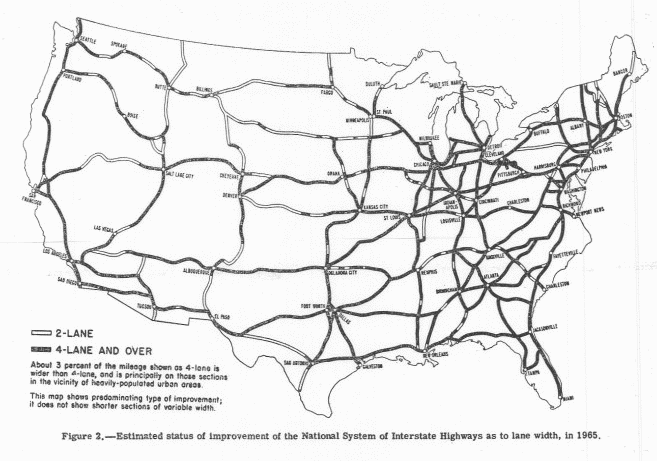
1955 map: The planned status of U.S. Highways in 1965, as a result of the developing Interstate Highway System.
The publication in 1955 of the General Location of National System of Interstate Highways, informally known as the Yellow Book, mapped out what became the Interstate System. Assisting in the planning was Charles Erwin Wilson, who was still head of General Motors when President Eisenhower selected him as Secretary of Defense in January 1953.